TfL Go: Plan, Pay, Travel
- 4.6
- Rating
- 1.00M
- Installs
- Free
- Price

 Analysis by App-foxy
I found TfL Go most useful when I treated it as a London travel companion rather than a complete replacement for every transport tool on my phone. It is the official app from Transport for London, built for planning journeys across the capital, checking routes, and making sense of a network that can feel confusing when several lines, walking sections, and service changes overlap. My overall impression is positive: it is focused, practical, and especially helpful when I want information from the organisation running the network itself.
The app is free, aimed at everyone, and sits in the Maps & Navigation category. It has reached more than a million installs and holds a 4.4 average from roughly 46 thousand ratings, which matches my experience of a mature public-transport app that is generally dependable but not completely frictionless. The current version is 3.9.0, and it runs on Android 8.0 or later. Those details matter if you are using an older phone, because an otherwise suitable device may still need an operating-system update before installation.
Where journey planning usually gets stuck
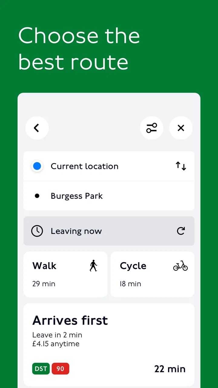
The first difficulty is not usually finding a route. It is understanding what the suggested route means in real life. A journey can look simple on screen but involve a platform change, a longer walk inside a station, or a decision about whether to stay on a train for a slower but easier trip. I found that TfL Go is most valuable when I open the journey details instead of accepting the first result immediately.
You May Also Like

 Blood Strike: 2.5 Anniversary
Blood Strike’s Loadouts Turn Every Drop Into a Tactical Gamble
A close look at Blood Strike’s custom loadouts: how fast access to signature weapons reshapes its battle royale rhythm, rewards preparation, and narrows the gap between fights.

 Pandora - Music & Podcasts
Pandora’s Music Is Easy to Start, but Harder to Recover
Pandora’s strength is its low-effort path from a seed to a station. Its weak spot is how much confidence it asks you to place in connection, setup, and quiet recovery.

 8 Ball Pool
 Is Built on Rivalries, Rematches, and Routine
A close look at the rivalries, rematches, shared routines, and unanswered safety questions that turn a quick pool match into a persistent mobile community.

 Samsung Music
’s Quiet Strength Is Playing What You Already Own
Its reach comes less from spectacle than from dependable access to a personal library. That simplicity is both the app’s strongest retention engine and its ceiling.

 AccuWeather: Weather Radar
AccuWeather Review: A Quick, Clear Forecast for Everyday Decisions
For everyday plans, the best forecast is the one you can understand quickly. AccuWeather makes rain timing, radar, and local conditions easy to act on, with a few trade-offs.

 Hill Climb Racing
Why Hill Climb Racing Still Turns Crashes Into One More Run
A tiny car, a bumpy hill and one more upgrade: Hill Climb Racing keeps resurfacing because its simple chaos makes every near-miss feel personal.
More From Our News Desk



That extra look helps me compare the shape of a journey: how many changes it involves, whether walking is part of it, and which transport modes are being used. For a visitor, this is more useful than a bare arrival estimate. London routes often have several reasonable alternatives, and the fastest option is not always the one I would choose with luggage, a child, or limited mobility.
A common source of confusion is expecting the app to behave like a general-purpose map. TfL Go is centred on Transport for London services, so it makes most sense for journeys involving the Underground, buses, Overground services, Elizabeth line travel, DLR, trams, and other TfL-connected options. If my trip depends heavily on a service outside that network, I would cross-check it with a broader mapping app or the relevant operator before leaving.
Another sticking point is live information. A route planner can show a sensible path, but conditions can change after the route is calculated. I have learned to check the service status again shortly before boarding, particularly when travelling across central London at a busy time. A planned route is a starting point, not a promise that every train or connection will remain exactly as shown.
The most useful habit is to check the route, then check the network conditions separately. These are related tasks, but they answer different questions. The route tells me how to travel; the status information helps me decide whether that plan is still sensible now.
Why the first result is not always the best result
When I am travelling alone with time to spare, I may accept a route with more walking if it avoids a crowded interchange. When I am carrying a suitcase, I prefer fewer changes even if the journey is not theoretically the quickest. TfL Go is better when I use its information to make that judgement rather than following the first suggestion without thinking.
This is also where the app can feel less comfortable for people who want a fully visual, door-to-door experience. A general map may be better at showing the exact walk from a hotel entrance to a station entrance, or the final path from a stop to a small venue. TfL Go is strongest once the TfL portion of the journey is the main concern.
Setup checks that prevent avoidable trouble
Before relying on the app for an important trip, I would install it while connected to a stable internet connection and open it once at home. That gives me time to see whether the phone can run the current release and whether the app behaves normally before I am standing on a platform. Since the minimum operating-system requirement is Android 8.0, older Android devices deserve a quick compatibility check first.
I also recommend searching for a familiar London journey during setup. I do not need to travel anywhere; I simply want to confirm that the map loads, places can be found, and the journey-planning screen is understandable. This small test exposes problems such as an outdated operating system, a temporary connection issue, or a phone that is running short of storage.
Location access is another practical consideration. If I search by typing a station or address, I can usually plan without depending on live positioning. If I want the app to understand where I am starting from, location access becomes more important. I prefer to enter a clear departure point manually when I am indoors, underground, or near several similarly named stops, because a phone may not identify my exact position reliably in those situations.
I do not assume that a map application can replace mobile connectivity everywhere. Underground sections, station interiors, and crowded areas can all make data access inconsistent. Before leaving, I note the key parts of the route in my head or take a screenshot for personal reference. I still return to the live app when I can, but I do not make my entire journey depend on one screen refreshing at the exact moment I need it.
For visitors, the best setup is to test the app with the actual names of the places they plan to visit. London has stations, stops, and neighbourhoods with similar names, and typing the destination carefully is safer than choosing the first familiar-looking result. I also check whether the selected starting point is the station entrance or simply the station area, since that distinction can affect the walking part of the journey.
How I prepare the app for a real day out
My preparation is simple. I plan the first journey from the place where I will actually begin, inspect the changes, and then repeat the process for the return trip. The return route may be different because service conditions, opening times, or the direction of travel can change the practical choice. Planning only the outbound leg is an easy mistake, especially after a long day when I have less patience for experimentation.
I also avoid entering a vague destination when a specific station or stop is available. “Museum” or “market” may describe an area, while the nearest TfL stop gives the app a more useful transport target. I then use a separate map if I need the final walking directions to a precise door. This division of labour works better for me than expecting one app to be perfect at both network planning and street-level navigation.
Because TfL Go is free, it is easy to keep installed even if I use another map as my main navigation tool. That combination is worthwhile: I use the broad map for the complete journey and the TfL app for official network context. People who want one application to handle every transport provider, ticketing situation, and walking detail may find this arrangement more convenient than using TfL Go alone.
Recovering when a planned workflow breaks
When the app does not load a journey, I start with the least dramatic explanation. I check whether other apps can reach the internet, close and reopen TfL Go, and try the search again with a clearer station or stop name. If the issue affects only one destination, I change the wording rather than assuming the whole app is broken.
If the map appears incomplete or information seems stale, I compare the result with the service-status information available in the app and, where necessary, with announcements at the station. I do not repeatedly recalculate the same route without checking the underlying situation. A new calculation cannot fix a disruption that is still affecting the network.
When a route contains an unexpected walking section, I inspect the journey details before abandoning it. Sometimes the walk is an intentional connection between nearby stops or stations; sometimes I have selected a destination that is not the entrance I had in mind. If the walk is unsuitable, I search again from a more precise starting point or choose another route with fewer changes.
For a failed location search, I switch to manual entry. This is particularly useful near large stations, where a phone may place me on the wrong side of a complex building. I would rather spend a few seconds selecting the correct station than begin a journey with an inaccurate starting point and discover the mistake after boarding.
Updates can also be part of the solution. The app was released on April 22, 2021, and the current version is 3.9.0, so I keep it updated through the normal app-store process. I do not treat an update as a guarantee that every problem will disappear, but using an old release can make troubleshooting harder and may leave me with behaviour that the developer has already addressed.
What I do when the phone or connection is the weak link
If TfL Go works on a reliable connection but not in one particular place, I suspect the environment before the app. Underground areas, thick station structures, crowded networks, and weak mobile coverage can all interrupt a live journey-planning workflow. I move to a location with better reception, try again, and keep the essential route details visible rather than repeatedly tapping a screen that cannot refresh.
A low battery can create a different kind of failure. Even when the app itself is functioning, extended map use, location services, and mobile data can make a phone harder to rely on for the rest of the day. I carry a charged phone and avoid opening the map unnecessarily while walking a route I already understand. This is not a TfL Go feature; it is simply sensible preparation for any phone-based travel plan.
If the app closes unexpectedly or the phone becomes unresponsive, I first restart it and test a short, familiar search. If the problem continues, I use another source for immediate travel information rather than troubleshooting at the platform edge. The app is helpful, but missing a train while trying to repair an app is rarely a good trade.
When the app is not the cause
Some frustrations come from the transport network itself. A delayed train, a crowded platform, a closed entrance, or a missed connection can make a correct route feel wrong. TfL Go can help me reassess the next step, but it cannot remove the physical limitation. I pay attention to station announcements and staff instructions when they conflict with what I saw earlier on my phone.
There is also a difference between a route that is technically possible and one that is comfortable. A journey involving several changes may be reasonable for a local commuter but exhausting for someone unfamiliar with London. I use the app to identify those changes, then decide whether the route fits the person travelling. For accessibility needs, luggage, or a tight appointment, I would verify the practical details through current official guidance and allow extra time rather than relying only on the visual route summary.
The app is not the ideal choice for every traveller. Someone planning a trip that combines TfL with several independent rail operators may prefer a broader journey planner. Someone who mainly needs turn-by-turn walking directions may find a general map more natural. And someone who wants detailed payment management should check whether the specific task they have in mind belongs in TfL Go or requires another official channel. Its value is greatest when the central question is, “How should I use the TfL network for this journey?”
On the other hand, I would choose it over a generic map when I want a TfL-focused view of London travel. The official perspective is useful for understanding the network rather than merely drawing a line between two addresses. It also gives me a dedicated place to revisit the journey when conditions change, instead of sorting through unrelated businesses, roads, and points of interest.
A realistic evening journey
Imagine I am leaving a museum in the afternoon and meeting a friend across town. I enter the nearest known station rather than relying on the phone’s location, select the destination station, and inspect the suggested route. I notice that one option has fewer changes while another appears quicker but includes a more complicated interchange. Because I am carrying a bag and do not know the station well, I choose the simpler route.
Before walking to the platform, I check the current service information. If the line is operating normally, I follow the plan but keep the route details available. If there is a disruption, I recalculate from the station I am actually at, not from the museum. That small change prevents the app from suggesting a route that assumes I can still reach the original starting point.
After meeting my friend, I plan the return journey separately. The best route home may not mirror the outbound route, and the two of us may prefer a different balance between walking and changing trains. If the final destination is a residential address, I use TfL Go to reach the appropriate station and a general map for the last streets. This workflow keeps each tool doing the job it handles best.
My practical verdict for London travellers
I recommend TfL Go to visitors, commuters, and occasional London travellers who want a focused way to understand TfL journeys. It is particularly good for checking the network before setting out, comparing changes, and reassessing a plan when service conditions shift. The fact that it is free and rated for everyone makes it an easy app to try, while its broad adoption suggests it has become a familiar option for many Android users.
I would not make it my only travel tool. Its focus is also its limitation: it is not a universal map, and it cannot turn uncertain connectivity or a disrupted network into a smooth journey. I get the best results by pairing it with careful destination selection, a quick service-status check, and a backup plan for the parts of a trip that fall outside TfL’s core network.
My strongest recommendation is to test the app before the day you need it, plan from the correct station or stop, and inspect the route details instead of trusting the first result blindly. If a search fails, simplify the place name, enter the starting point manually, and check whether the phone or connection is the real problem. Those habits remove most of the friction I encountered.
For me, the app earns its place because it answers a specific question well: how can I travel through London using TfL services right now? When that is the question you need answered, TfL Go is a practical, official companion rather than unnecessary extra clutter. Just keep a broader map or another information source available for non-TfL connections, precise walking directions, and situations where the network itself—not the app—is changing underneath your plan.
FAQs for TfL Go: Plan, Pay, Travel
01What is TfL Go, and how does it work?
TfL Go is a comprehensive travel app designed to help users navigate the Transport for London (TfL) network efficiently. It provides real-time information on routes, schedules, and service updates. Users can plan journeys, receive live status alerts, and access maps for buses, tubes, and trains, making travel in London more seamless.
02Is the TfL Go app free to download and use?
Yes, the TfL Go app is free to download and use. However, while the app itself incurs no cost, users will still need to pay for their travel fares on the TfL network. The app provides information and planning tools but does not cover the cost of actual travel.
03Can I use TfL Go to pay for my travel fares?
No, TfL Go does not support payment for travel fares. It is primarily a planning and information tool. For payments, users should use contactless cards, Oyster cards, or the official TfL Oyster and Contactless app. TfL Go assists with journey planning and service updates.
04Does TfL Go provide real-time service updates?
Yes, TfL Go offers real-time service updates, helping users avoid disruptions and plan alternative routes if necessary. It provides live status for buses, trains, and tubes, ensuring that travelers have the most current information to make informed decisions during their journeys.
05Is TfL Go available on both Android and iOS devices?
Yes, TfL Go is available for both Android and iOS devices. Users can download the app from the Google Play Store or the Apple App Store. It is designed to provide a user-friendly experience across different platforms, ensuring accessibility for a wide range of users.
Pros
- User-friendly interface for easy navigation.
- Real-time updates on transport schedules.
- Integrated payment system for convenience.
- Detailed maps and route planning features.
- Customizable alerts for disruptions.
Cons
- Requires constant internet connection.
- Limited offline functionality.
- Drains battery quickly on prolonged use.
- Some features require in-app purchases.
- Occasional lag in live updates.

TfL Go: Plan, Pay, Travel
Gallery